Somewhere in the photographs that made you consider Pakistan, there is a picture you can already see with your eyes closed. A red sandstone courtyard. A ridge of bare rock above a river. Sand dunes with no palms in sight. This post is about those pictures and where each one sits on the map, because most people recognise the view and cannot place it near a route.
Nothing here is a ranking. Nobody publishes a count of photographs taken at each viewpoint, so “most photographed” describes how familiar these views are, not a league table position. What follows is seven views you have probably met already, with an honest note on what each asks of you. If you would rather browse than read, the full photo gallery has far more.
How to Use This List When You Are Planning a Trip
Two things to hold in your head. Pakistan is not small: Lahore, where the list begins, and the Hunza valley, where most mountain views sit, are a full day’s drive apart, and the coast is another direction entirely. And a view that looks effortless in a photograph is often the end of a jeep track, with the last stretch walked. Treat each entry as a place plus a cost in days.
Badshahi Mosque, Lahore: The Photograph Everyone Takes First
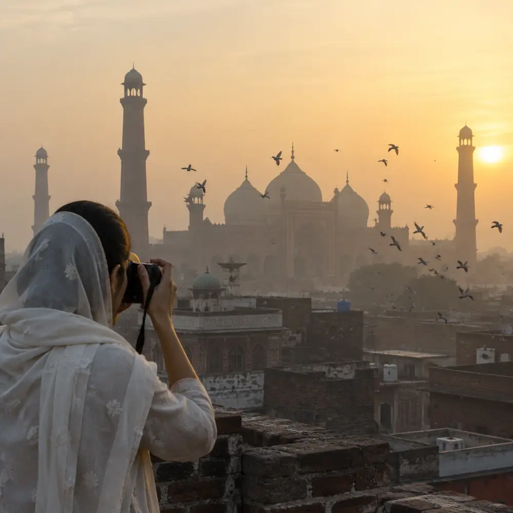
The vast red sandstone courtyard with a prayer hall at the far end, usually shot at dusk with people as small dark figures on the paving, is Badshahi Mosque in Lahore. It sits in the old city opposite the Lahore Fort, and it is the first photograph most visitors take, because it is the easiest of these views to reach: a flight into Lahore, a short ride from your hotel, and you are standing in it.
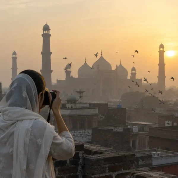
It was built in the seventeenth century under the Mughal emperor Aurangzeb, and it has the quality Mughal architecture does best: the longer you stand in it, the more the symmetry works on you. Mornings are quiet; evenings bring the light photographers want and far more people. It asks almost nothing beyond modest dress, shoes off and a scarf for women. See it on day one: a first visit to Lahore covers the old city around it, and the forts worth a detour puts the fort across the square in context.
Faisal Mosque, Islamabad: The One That Does Not Look Mughal
The second famous photograph confuses people, because it does not look like the Pakistan they expected. A white modern structure shaped like a desert tent at the foot of the Margalla hills in Islamabad, four tall minarets, no dome at all. Faisal Mosque was designed by a Turkish architect and completed in the 1980s, its shape taken from a nomadic tent rather than the Mughal tradition.
It is also the simplest view here after Badshahi: inside the capital, on the road network, a taxi away from anywhere central. People photograph it from the courtyard looking up at the tent angles, or from the hills behind in late afternoon. Islamabad is a different world from the old cities, wide roads and planned sectors, a soft landing before the mountain flights. Most trips run Lahore, then Islamabad, then north, and both mosques come with that route.
The Passu Cones, Hunza: The Ridge You Have Seen Without Knowing Its Name
Here is the one that stops people. A row of sharp, bare, almost serrated peaks rising straight out of a river valley, a thin road along the water below. That ridge is the Passu Cones, above the village of Passu in the Gojal area of upper Hunza, Gilgit-Baltistan, and it is the backdrop of much of the Karakoram Highway photography in circulation.
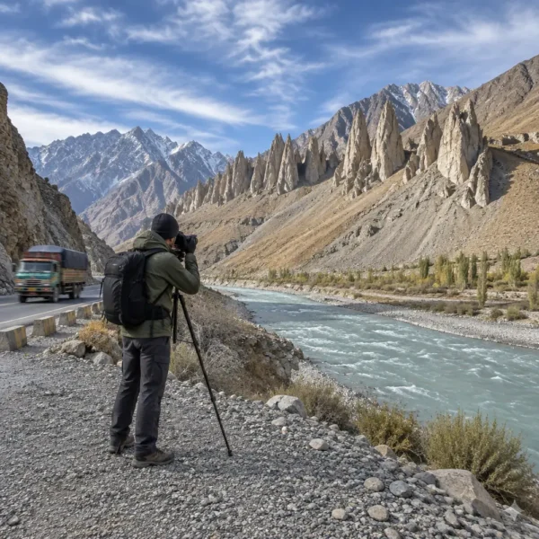
Reaching this one costs days rather than money. From Islamabad you either take a mountain flight to Gilgit, which depends on the weather, or drive the Karakoram Highway (the road linking Pakistan to China over the Khunjerab Pass) in two long days. From Gilgit it is a few hours up the valley, and then the viewpoint is beside the road, a strange thing to say about one of the great mountain views on earth. Two nights answers it: planning a few days in Hunza covers the bases, the Karakoram Highway guide covers the road, and our northern mountain tours run this valley as their spine.
Attabad Lake, Hunza: The Water That Took a Road
The photograph of impossibly turquoise water between bare brown slopes, sometimes with a boat on it, is Attabad Lake. It is the newest landscape here, and the story explains the colour: in 2010 a landslide came down across the Hunza river and blocked it, and the backed-up water drowned part of the old highway. A tunnel was later cut through the rock to carry the road past it.
Because it sits on the main valley road, this is a mountain view you get without walking: you drive past it on the way to Passu. The colour shifts through the day, and boats run on the lake in season, though operations are the sort of thing to confirm locally rather than from a blog. If your mental image of northern Pakistan is water, you want the lakes worth the drive: that post is about detours, this one about views you already know.
Nanga Parbat from Fairy Meadows: The One That Needs a Jeep and a Walk
The snow mountain filling the sky above a green meadow with pines in the foreground is Nanga Parbat seen from Fairy Meadows. It is the most physically demanding view here, and the one people most often underestimate after seeing it on a screen.
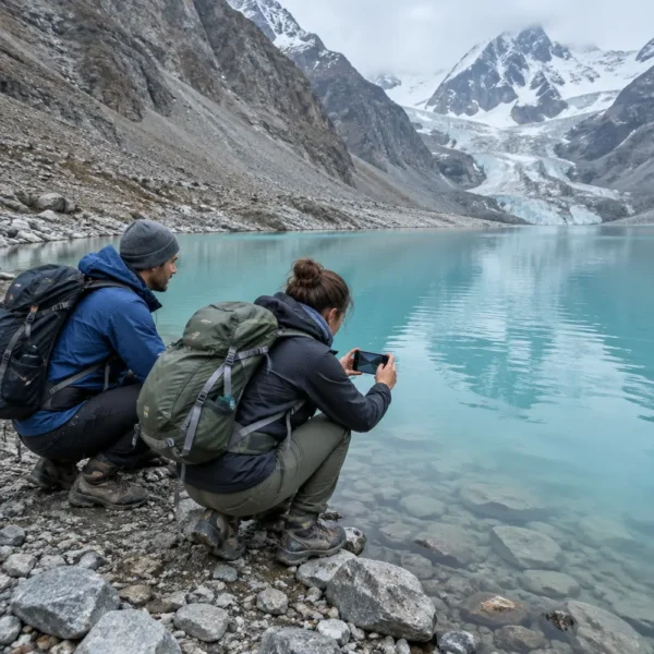
Getting there means leaving the highway, taking a jeep up a rough track, then walking the last stretch with your bag carried or portered. It is not technical climbing, but it is a day where the transport is part of the experience and the weather decides what you see. Nanga Parbat is the western anchor of the Himalaya, and this is the classic view of it, seen across the meadows rather than from a road. Because the jeep and the walk change the shape of a trip, plan rather than improvise: what the Fairy Meadows trip involves sets out the sequence.
The Cold Desert Around Skardu: Sand at the Foot of a Glacier
The photograph that looks like a mistake, sand dunes with bare brown mountains behind and no sea anywhere, is the cold desert at Sarfaranga near Skardu, in Baltistan. It is high, dry and cold, the dunes sit on a valley floor with mountains rising out of them, and in winter there can be snow on the sand.
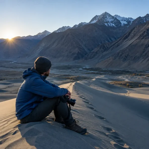
Skardu is reached by another mountain flight or by road from Gilgit, so this belongs to the second half of a northern trip. The desert is close to town, one of the easier high-altitude views once you are there, and Skardu is also the base for the Deosai plateau and the approach to K2, both journeys of their own.
The Makran Coast: The Photographs Almost Nobody Takes
The odd one out. Pakistan’s southern coast along Balochistan runs from near Karachi towards Gwadar on the Arabian Sea, and it produces a different set of images entirely: rock formations carved by wind, mud volcanoes, empty beaches, fishing boats, a coastal road with almost no traffic. If you have seen one dramatic photograph of Pakistan that was not a mountain, it quite possibly came from here.
Almost nobody takes these photographs, which is the point of including it. It needs its own trip: nowhere near Lahore, Islamabad or Hunza, and a long drive. It rewards people who like empty places more than people who want a checklist, so few first trips include it.
Which of These Fit Into One Trip, and Which Need Their Own
Three clusters emerge. The city pair, Badshahi Mosque in Lahore and Faisal Mosque in Islamabad, sit on the main road and rail network, need nothing beyond a hotel, and start almost every itinerary.
The northern group, the Passu Cones, Attabad Lake, the Skardu cold desert and at the harder end Fairy Meadows, all sit in Gilgit-Baltistan and connect, but the connecting takes days. A sensible journey runs Hunza first and Skardu second, with Fairy Meadows added deliberately, not squeezed in.
The Makran coast is a separate trip south. Attaching it to a northern journey is how people end up spending their holiday in a vehicle.
With ten days, the honest split is the two cities plus Hunza, with Skardu if the flights work. With two weeks, everything in the north fits, and the coast is the one to save. We plan these routes for small groups and will tell you which combination is realistic for the days you have, including when the answer is fewer places. Message us on WhatsApp at +92 344 7181087, or tell us which ones you want to see. All our tour packages are listed if you would rather start from a fixed shape.
Are these really the most photographed places in Pakistan?
They are the views that turn up most often when people share photographs of Pakistan, which is a fair way to describe them and not a measured ranking. Nobody publishes a count of photographs taken at each viewpoint, so treat the phrase as a description of how familiar these views are rather than a statistic.
Can I see several of these in one trip?
The Lahore and Islamabad views sit on the main road and rail network and are easy to pair. The Hunza and Skardu views need a flight or a long drive north first, and the Makran coast is a separate trip to the south entirely. Most visitors do the northern group in one journey and save the coast for another time.
Which of these is easiest to reach for a first-time visitor?
Badshahi Mosque and Faisal Mosque are the simplest: both sit inside major cities with hotels, restaurants and transport around them. Everything else on this list needs either a mountain flight or a long road day, and the hardest of them needs a jeep and a walk on top of that.
Do I need a guide to photograph these places?
Not for the city mosques, and not for the Attabad Lake and Passu viewpoints along the main valley road. A guide earns its place on the side valleys, the jeep tracks and the timings, which is where the harder viewpoints actually are. The exact rules for any site, including opening hours, depend on the site and the date, so confirm before you build a day around it.
What time of year makes these views look like the photographs?
The mountain views are clearest in the cooler months when the haze lifts, and the lake colours change through the year. We do not repeat a month-by-month guess here, because conditions move; the month-by-month guide to the seasons sets out the seasons properly.