

Northern Pakistan: Valleys, Peaks and Where to Go
Northern Pakistan is the part of the country that most travellers come for: the Karakoram and Himalayan ranges, the valleys cut between them, and a highway that runs from the plains to the Chinese border. It is not one destination. Hunza and Skardu are a day apart by road, Swat and Chitral sit on the other side of the mountains, and Murree and the Neelum valley are closer to Islamabad than any of them.
This page is the map: which province each valley belongs to, what each one is actually like, how long the drives take, and which months work. Every place below is a page in its own right, so you can read the valley you are interested in and skip the rest.

Which province is which
Guidebooks blur the north into one region, but the differences matter for planning. Gilgit-Baltistan holds Hunza, Skardu, Gilgit and Fairy Meadows, is reached by the Karakoram Highway or by air, and has its own permit rules at the checkpoints. Khyber Pakhtunkhwa holds Chitral, Swat, Kalam, Naran, Kaghan and Kumrat, all reached by road from Islamabad without crossing into Gilgit-Baltistan at all. Azad Kashmir is the Neelum valley and the hills above Muzaffarabad, green rather than glaciated. And Murree, the old hill station, is in Punjab, which is why it fills up with Lahore and Islamabad families at weekends.
The valleys and towns, one by one
Ten places that between them cover the north. Most trips pick two or three, because the driving between them is the thing that eats the days.
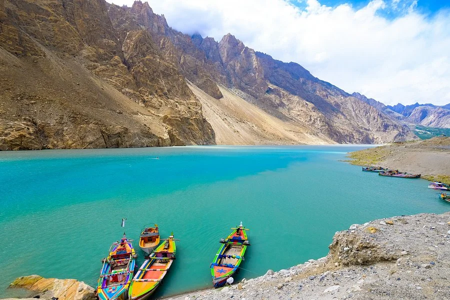
Hunza
Karimabad under Rakaposhi, the forts at Baltit and Altit, Attabad Lake and the road north to Khunjerab. The valley most people mean when they say the north, and the easiest to travel in.

Skardu
The Indus valley base for Deosai, Shangrila and the road towards K2. Drier and colder than Hunza, with wide braided rivers and a very different light.

Gilgit
The regional capital, and the junction where the Karakoram Highway meets the roads to Skardu and Chitral. Most trips pass through rather than stay, but the bazaar and the bridges are worth a morning.

Fairy Meadows
A meadow at roughly 3,300 metres facing Nanga Parbat, reached by jeep track from Raikot bridge and then on foot. The closest most travellers get to an eight thousand metre wall without a trek.

Chitral
The Kalash valleys to the south of the town, Tirich Mir above it, and the Shandur pass on the old road towards Gilgit. Remoter than the rest of this list, and worth the effort.

Naran and Kaghan
Saif-ul-Malook, Lulusar and the Babusar pass road, which is the short way from Islamabad into Gilgit-Baltistan when it is open. Busy in summer for a reason.

Kumrat
A forested valley in Upper Dir with the Panjkora running through it. Quieter than Swat, mostly visited by Pakistani families, and the road in is part of the trip.

Swat and Kalam
Green river valleys and the road up to Kalam and Mahodand. The gentlest mountain trip from Islamabad, and the one that suits families with small children best.
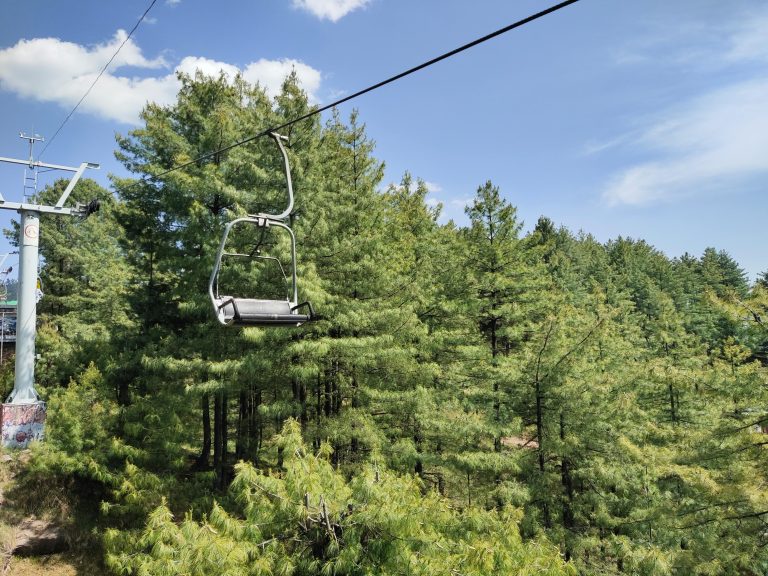
Murree
The old hill station an hour out of Islamabad. Best on a weekday and out of season, and best known in January when the snow brings the whole city up the hill.

Kashmir and Neelum
The Neelum valley, Arang Kel and the road up to Kel and Sharda. Green rather than glaciated, open later in the season than the high passes, and close enough to Islamabad for a short trip.
Islamabad, where every northern trip starts
Almost every road in this guide begins in Islamabad, and it is worth a day of its own before you climb: the Faisal Mosque, the Margalla hills and the old bazaars of Rawalpindi are all within half an hour of each other. We collect from Islamabad and Rawalpindi hotels, and from the airport when your flight lands at an awkward hour. See Islamabad tour packages for what a stopover day looks like.
How long the drives actually take
Distances in the mountains are measured in hours, not kilometres, and the numbers below assume daylight, good weather and no roadworks. A landslide or a broken truck can add two hours to any of them.
| Route | Approximate time | Notes |
|---|---|---|
| Islamabad to Naran | 6 to 7 hours | Mansehra, Balakot, then up the Kaghan valley |
| Islamabad to Chilas | 11 to 13 hours | The usual overnight break on the Karakoram Highway |
| Islamabad to Gilgit | 16 to 18 hours | Usually split over two days at Besham or Chilas |
| Islamabad to Skardu | 18 to 20 hours, or a one hour flight | Flights are weather dependent |
| Gilgit to Karimabad | About 2 hours | Sealed road the whole way |
| Karimabad to Khunjerab | 3 to 4 hours each way | A long day, and cold at the top |
| Skardu to Deosai | 2 to 3 hours | Track, open roughly July to September |
When to go, and what each season gives you
April and early May is blossom in Hunza and Skardu and green in Swat, with the high passes still shut. June to August opens Khunjerab, Deosai and Babusar, and is monsoon in the lower valleys, so Gilgit-Baltistan stays dry while Murree and Naran get rain. Late September and October is the clearest light of the year and the best time for photographs, before the snow starts. November to March is winter: the passes close, Babusar shuts, and Hunza and Skardu go quiet but stay reachable along the highway.
One planning rule worth knowing: the Babusar pass is the short route between Naran and Gilgit-Baltistan, and it is closed for roughly half the year. When it is shut, everything goes the long way round on the Karakoram Highway through Besham, which adds most of a day.
Frequently asked questions
What counts as northern Pakistan?
The Karakoram and Himalayan valleys in Gilgit-Baltistan, the hill districts of Khyber Pakhtunkhwa, the Neelum valley in Azad Kashmir, and the Galiyat around Murree in Punjab. Hunza, Skardu and Gilgit are in Gilgit-Baltistan; Swat, Naran, Kaghan, Kumrat and Chitral are in Khyber Pakhtunkhwa.
When is the best time to visit northern Pakistan?
April and May for blossom and green valleys, June to August for the high passes, and late September to October for clear mountain light. The Karakoram Highway itself runs all year, but Khunjerab, Deosai and Babusar close for the winter.
Do I need a permit to travel in the north?
No permit is needed for the main valleys: Hunza, Skardu, Gilgit, Chitral town, Swat, Naran or Murree. Some border areas and a few valleys close to the frontier need one, and foreign nationals have to be registered at the checkpoints on the highway, which we handle as part of the trip.
How do I get there from Islamabad?
By road up the Karakoram Highway, or by air to Gilgit and Skardu. Flights take about an hour and are frequently cancelled by weather, so we plan the road as the reliable option and treat the flight as a bonus.
How many days do I need in the north?
Five to seven days for one valley with the driving included, and ten to fourteen to pair Hunza with Skardu. Adding Chitral, Kumrat or the Kalash valleys needs another trip rather than another day.
Is the north safe for foreign travellers?
Yes on the routes described here. The highway and the main valleys are busy with local traffic, we travel in daylight, and the checkpoints are routine rather than a problem. We check conditions before every departure and change the plan if the road says so.
Is it suitable for families and older travellers?
The valleys are, and the driving is the hard part. Hunza sits around 2,400 metres and Skardu higher, so we keep the first day light on altitude, and we shorten the sightseeing rather than the sleeps.
Can I combine the north with the south of Pakistan?
Yes. Islamabad sits between the two, so a fortnight can start in Lahore, climb to Hunza or Skardu and finish in Karachi. See southern Pakistan for the other half of that trip.
Where to go next
The full collection, with the itineraries and prices, is on our Northern Mountain Tours page. If you would rather have one valley built around your own dates, start with the Hunza guide or tell us what you want to see.
Tell us which valley, and we will build the days around it
Send your dates, how many are travelling and whether you want a group departure or a private tour. We reply with a day by day plan and a firm price, in rupees for domestic travellers and US dollars for guests from abroad.